Yesterday (Saturday, September 1st, 2012), my friend Alissa and I completed a Presidential Traverse (“presi”) in New Hampshire’s White Mountains.
 |
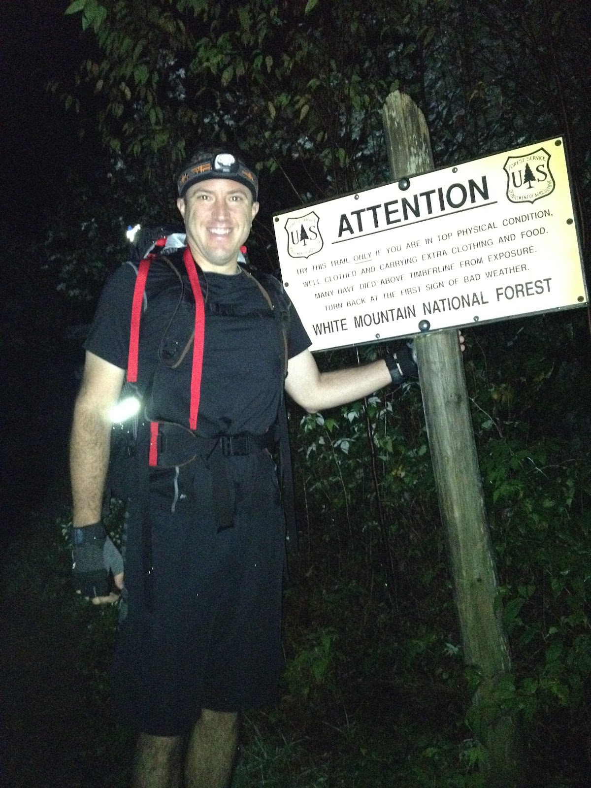
| Appalachia trailhead around 3:30am. |
This post contains many details, which most people will probably find boring. But I found several trip reports online, which helped my research, so I want to give back to the internet community out there. It’s also my diary 😉
The presi is a big and long hike, covering *all* the summits in the Presidential Range which are named after US presidents: Madison, Adams, Jefferson, Washington (highest mountain in the northeast US), Monroe, Eisenhower, and Pierce. There are numerous other peaks nearby, which may be included at the hiker’s discretion. (For example, we added Franklin, and meant to add Clay, but skipped it in a speed rush.)
As SummitPost says, “The Presidential Traverse is arguably the most spectacular and challenging one-day hike in the Northeast. Unquestionably, it passes over the highest peak in the Northeast, as well as the second, the third, the fourth, and the fifth, a couple of sub-peaks that are just as high, and a couple of “smaller” peaks that are still among the fifty highest in New Hampshire.”
 |
| Bring it. On the Mount Madison ascent. |
You can read much more background and details on Wikipedia and other hiker blogs. The typical traverse is about 20 miles and 9,000 feet of elevation gain. Since you have to walk down everything you walked up, that’s about 18,000 vertical feet of elevation change.
In case you don’t hike often: that’s a TON of elevation change. Walking up and down is much different, and much harder, than walking along flats. It probably sounds intuitive but it’s hard to appreciate the degree of difficulty. For many people, 1,000 feet of elevation gain is plenty more than enough to hurt calves, knees, ankles, cause blisters or hot spots, and more — even before the descent.
The hike is challenging to do in one day. Not many try that aggressive variant. For most people, any one of the above peaks is a good, solid, even notable achievement. (Particularly if more difficult trails are used.) It’s a full day of climbing and hiking. Some people do this traverse in 2, 3, or more days, stopping in one of the huts or camp sites overnight.
 |
| A shooting star near the Mount Madison summit before sunrise — lucky capture. |
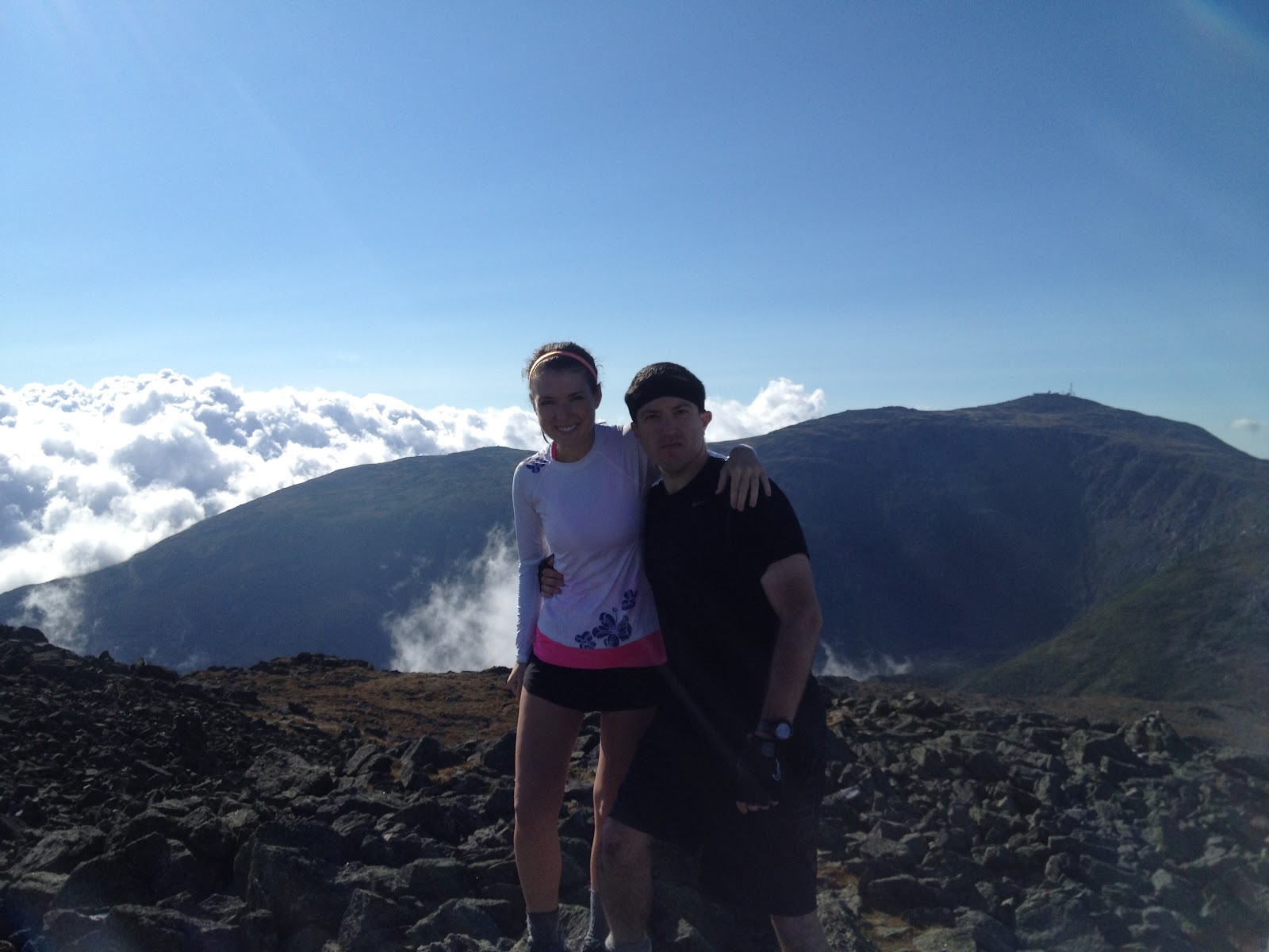
Not us. Alissa and I wanted to push ourselves and do it in one day. We’re both reasonably fit, although as it turns out, she’s much faster than me in the mountains. I also went a bit heavier than her, gear-wise, carrying some survival, evacuation, and medi gear for both of us. But I think that even on equal weight, she’d still kick my ass handily for speed at altitude.
More on the gear after the hike report below.
We did the traverse from north to south, which is the standard approach. We stayed overnight at a motel in Gorham, NH, waking up at 3am to get started early. The night before, we left one car at the southern endpoint of our hike, the AMC Highland Center. The morning of the hike we drove the other car to the Appalachia trailhead, our northern starting point, and left it there for the day.
We took the Valley Way trail up to Mount Madison. This trail is not easy, gaining more than 3,500 vertical feet in elevation over rocky terrain, in relatively short / steep distance.
We got to the summit of Mount Madison right before sunrise, around 5:30am. It’s a steep rocky scramble up and down from the Madison Hut to the summit. We had a gorgeous sunrise there, enjoyed the views for 5 minutes, had a snack, and moved on.
 |
| The sun about to rise on top of Mount Madison, around 5:40am. |
After coming down from Madison, we walked past Star Lake up the relatively direct Star Lake trail to the summit of Mount Adams. This entire trail is very exposed, all on rocks, often at the edge of the mountain. It’s scary if you’re not used to it, if your footing is uncertain, or if you’re ill at ease scrambling highly exposed terrain.
It also features a couple of chimneys and cracks, which we enjoy, but others might find very challenging. This was actually my favorite ascent of the day, due to its interesting technicalities.
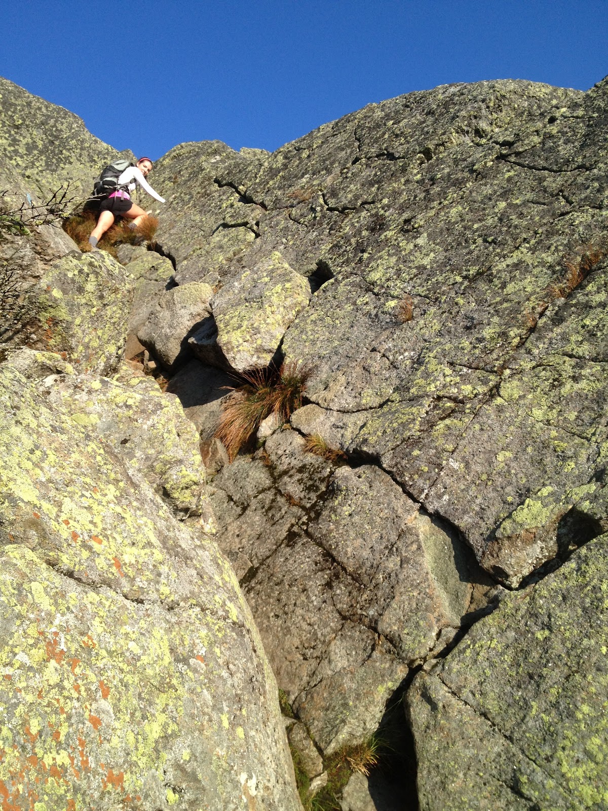 |
| Climbing a chimney up Star Lake trail on Mount Adams. |
We got to the summit of Mount Adams around 7:30am, had another snack, stayed 5 minutes, and started moving on the Gulfside Trail to Mount Jefferson.
 |
| Mount Adams summit around 7:30am. |
We got to Edmunds Col, a useful navigation and pace waypoint, at 8:15am. This is also notable because we walked past a group of three men seated down near the col. We said hi, as we always do, and they cheerfully said hi back. All looked normal and we kept walking forward.
Which is why we were surprised to hear a helicopter approach not two minutes later. It was a medevac / rescue helo, and it landed steps away from where we had walked. As we later found out from a US Forest Ranger, one of the three men had dislocated his kneecap (ouch!) the previous night. The group chose to camp out overnight (luckily they had tents and found a semi-flat area), rather than ask for rescue in that evening’s torrential downstorm and low visibility. So this morning the rescue crew came out for them.
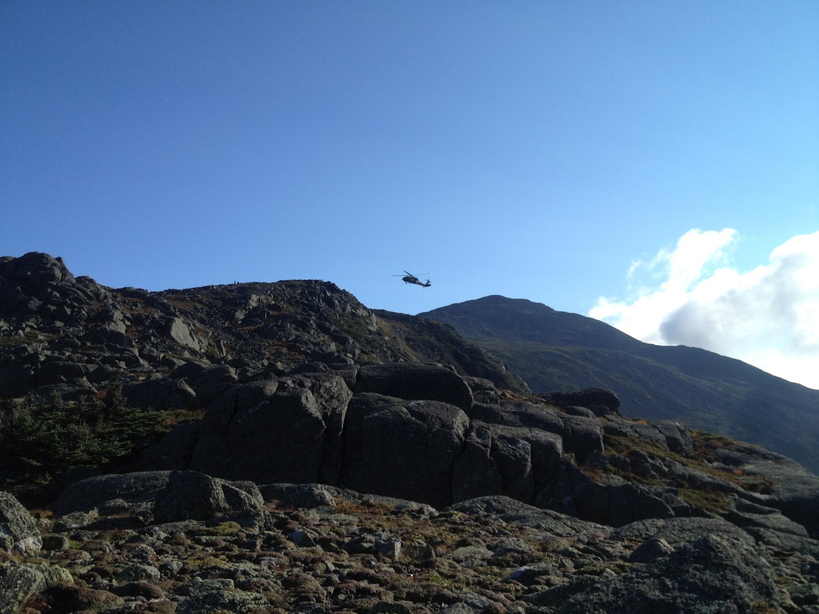 |
| Rescue chopper landing near Edmunds Col. Looking at Mount Adams in background. |
We kept climbing and got to Mount Jefferson’s summit around 9am. Not bad so far: 3 summits and much mileage by the time many people were just having breakfast. Most of our ascent, where again we took the most direct and steep route, was accompanied by the sound of the rescue helo. It finally left while we were near the summit, so it was back to near-silence, with just the sounds of our breathing.
Mount Jefferson’s summit has beautiful views. It’s about the same quality as the views from Mount Washington, but without the tourists. Highly recommended.
 |
| Mount Jefferson summit around 9am. Mount Washington in background. |
After another 5 minutes and a snack, we hoofed it down and continued along the Gulfside trail to Mount Washington. We wanted to tag Mount Clay along the way, but missed the loop trail intersection by accident. Maybe we were going too fast to notice, I’m not sure why. We saw its end, and I didn’t want to double back a full mile just for Clay.
Anyways, we got to the summit of Mount Washington by 11:15am, almost 2 hours ahead of the target pace I wanted, and well ahead of “book time.” We took our longest break of the day here, about 30 minutes to have some pizza, Goldfish, Gatorade, apply moleskin for blister prevention, and refill water.
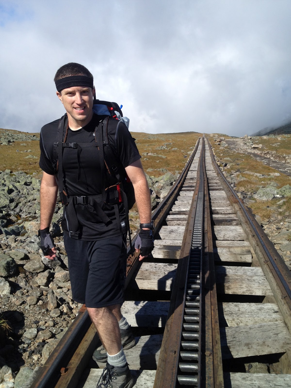 |
| Crossing the Cog Railway tracks on approach to Mount Washington. |
Then it was on to Mount Monroe, via the Lakes of the Clouds AMC hut. I always forget how beautifully-situated that hut is. We were there around 12:30pm, and didn’t stop. (Well, I didn’t stop at all, but Alissa ran ahead, then waited a few minutes for me to arrive.)
We hustled up Mount Monroe, a fun direct ascent, and hit that summit around 1pm. Then it was a longish but easy slog to Mount Eisenhower.
 |
| Mount Monroe summit, looking west. |
On the way we passed, and summited, Mount Franklin. It’s an easy peak and has some nice views from the top. We continued to Mount Eisenhower, with its huge cairn, which I bagged around 2:15pm. Alissa, again, was there a few minutes before me.
But this time the delay was partially due to her faster pace, and partially because I stopped to help splint up a man’s ankle. It was nice to see that I hadn’t forgotten my wilderness medicine course. Luckily another hiker nearby had a big multiday pack with a fancy first-aid kit, including a splint.
Public service announcement: if you spend time outdoors, please take this course or one like it.
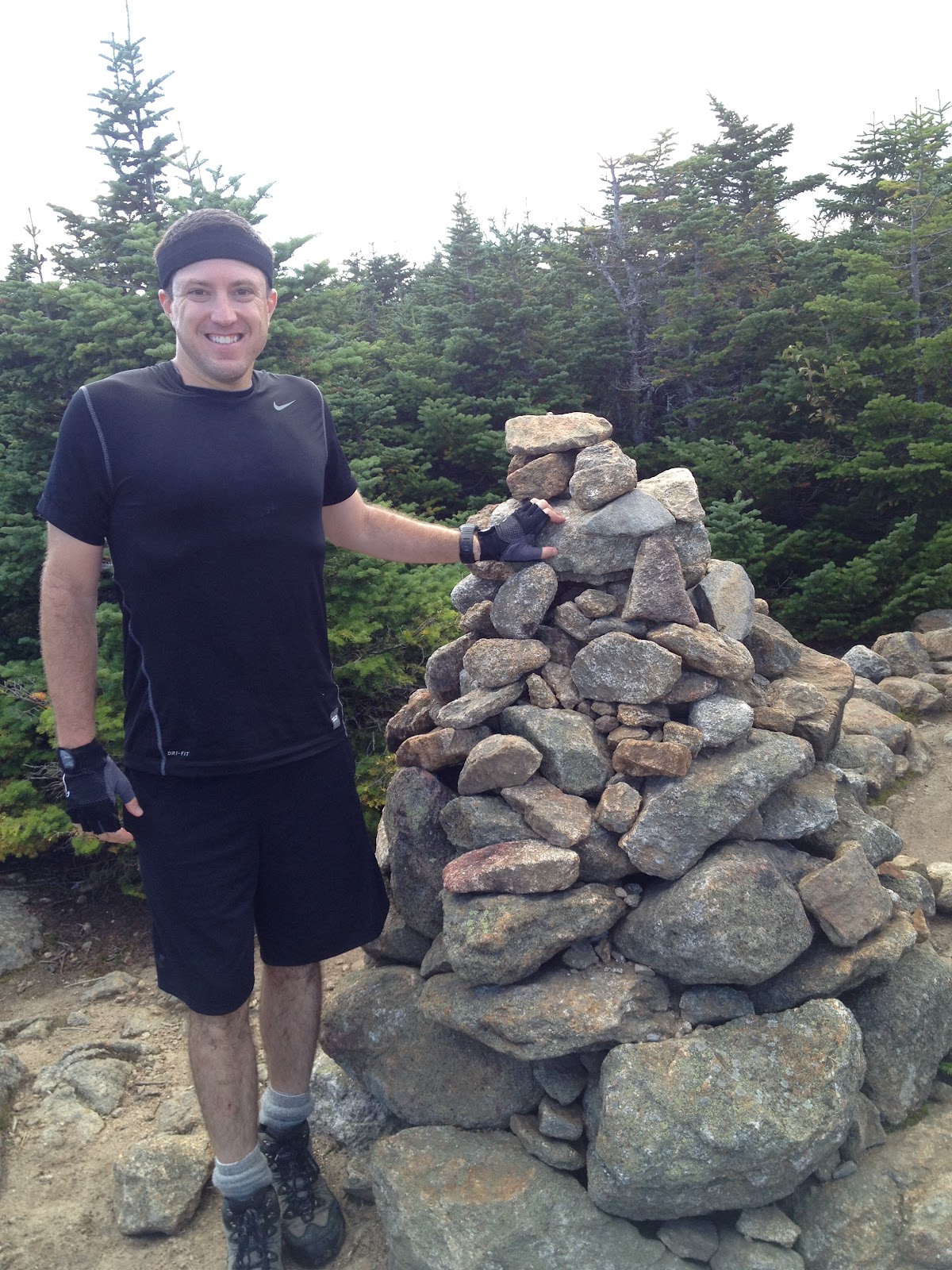
 |
| Summit of Mount Eisenhower, with its huge cairn. |
We didn’t stay long, and continued to Mount Pierce. I got there at 3:15pm, an hour after Eisenhower, and a solid 15 minutes after Alissa, who was still (impressively) jogging big chunks of the route.
 |
| Mount Pierce summit, the last required peak for a presi. |
From there we descended to the Mizpah hut, where we did a 2-minute break to fill water and empty bladders, and hiked down the Mizpah Cutoff trail to the end of Crawford Path. Alissa was faster again, and I was stopping a lot to take some nature photos.
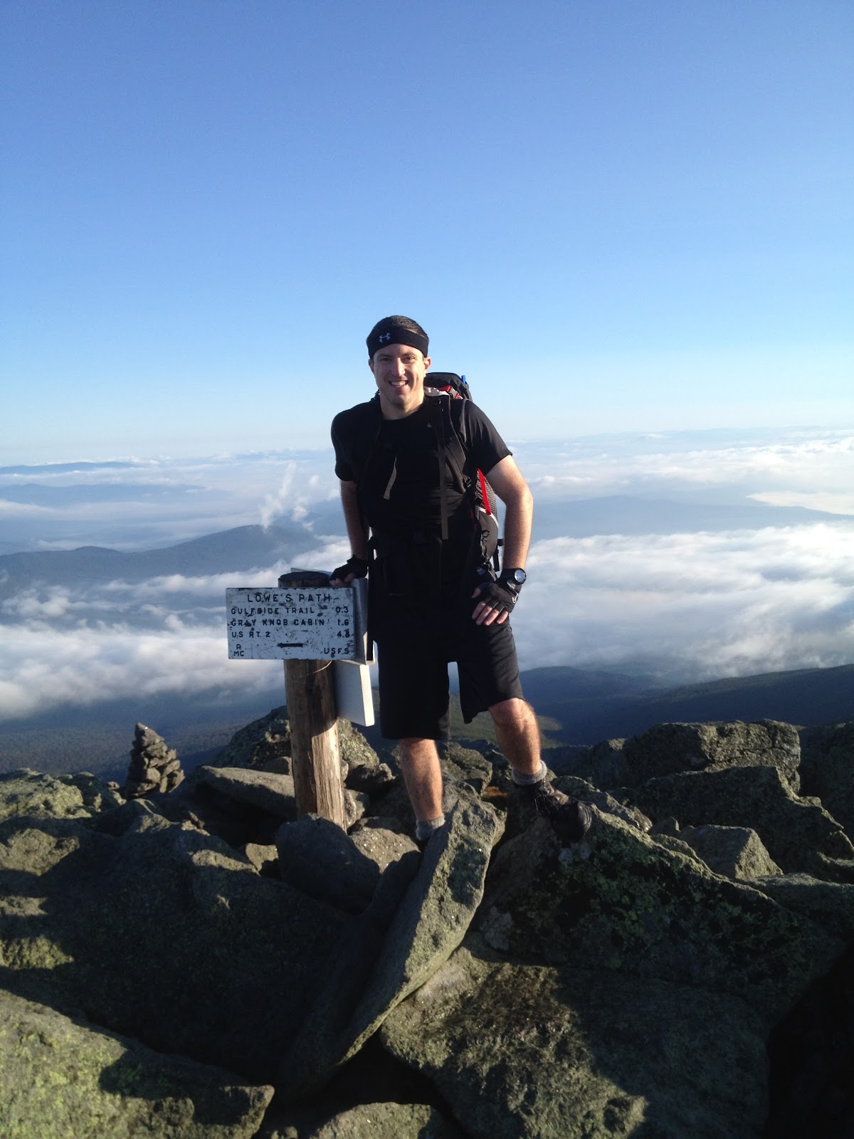
I got to the AMC Highland Center around 4:45pm, just about 13 hours after starting the hike. This was hours ahead of book time, and more than an hour ahead of the aggressive personal goal I’d set for myself, so I’m happy with the time. If I had hustled down Crawford Path, I could have easily cut off another 20-30 minutes, but I was chatting with folks and taking lots of photos.
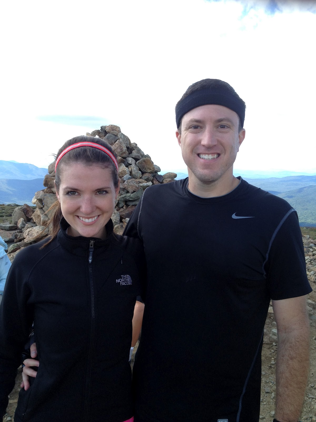
 |
| Obligatory victory pose picture at AMC Highland Center, around 5pm. |
We finished with plenty of daylight left, which is an important safety factor. We both felt like we still had plenty left in our legs.
Although we declined to do Mount Jackson and Webster on this hike, we would likely add them to a future traverse. The main reason for passing on them this time is that we still had to drive back 30 miles north to pick up the second car, and then drive down to Boston (3+ hours away, at night), grabbing dinner along the way. We made a good conservative choice.
Just a couple of closing thoughts on gear and food / energy.
Although I went relatively light (~25lb pack including water) I still carried (as always) medical and rescue equipment for two, including bivy sacks, supplemented first aid kits, and some cold-weather clothing (e.g. a fleece and a jacket, neither of which I used at all).
I could have ditched this gear and gone lighter. This would have let me switch from light boots to trail runners, covering more ground quicker. In the mountains, speed is safety.
I really like my current backpacking pack, a CiloGear WorkSack 60L. It’s so light for its size, so configurable, no wonder it keeps winning the serious mountaineering and alpinism awards.
It’s not a beginner’s backpack though: you need to be comfortable actually configuring backpacks (cinching, compression, daisy chaining, etc.) to use it well. Mine fits perfectly now, to the point where after this hike, my shoulders and back and neck didn’t even feel anything.
| My backpack, a CiloGear WorkSack 60L. |
I wore Under Armout Heat Gear boxers and shorts all day, and it was perfect. They’ve got that material nailed. I’ve raved about these products before, and will continue to do so.
We stopped at every summit to snack. I mostly had Clif’s Shot Bloks, but also a couple of simple dark chocolate bars. We had pizza and Goldfish at the top of Mount Washington. I personally drank about 7 liters (!) of water on the hike, and didn’t need to pee at all the entire day, so I was probably still a little too de-hydrated. We also each had a Red Bull each in the morning (~3:15am) and another in the middle of the day (~11:30am).
It felt like OK energy intake for me, although our caloric output / energy expenditure was high. For me, using the rough guide at NutriStrategy, I was spending ~650 calories per hour (carrying a 25-lb pack), for ~13 hours, so I spent ~8,500 calories.
This is an under-estimate, too, because I jogged several kilometers overall, not just walked them, and we had a bunch of steeps (both up and down) as well as rock scrambling. My intake was about 3,500 calories all told including the post-hike dinner, above normal, as expected.
We got lucky with fantastic weather, a beautiful day, and an accurate forecast, unusual for the White Mountains.
Alissa added a comment below which is totally true: we under-did the sunscreen. Thankfully neither of us got badly burnt, but we should have re-applied sunscreen throughout the day, and we didn’t.
Unfortunately, I did not have WalkMeter or RunKeeper turned on due to iPhone battery consumption issues, so I don’t have exact distance nor a KML export. Tallying it up from the trail maps, including some meandering we did to misc peaks, it looks like about 21 miles hiking for our specific trip.
Finally, a key fitness lesson learned: both Alissa and I are capable of sustained serious cardiac output for more than 12 hours straight. This is useful for a variety of challenges we hope to tackle in the future, separately and together. The cardio piece was not a challenge for me. My feet, with their blisters and soreness, were the limiting reagent, by far.
This was a great hike, my favorite one ever. I want to do more long hikes with ups-and-downs. I want to try and go lighter, light enough that I can jog big chunks of the way, meaning sneakers most likely. But there has to be good scenery as well, like we had yesterday.
As I told everyone I passed on the trail: hike smart, hike safe.
