This is one of a series of posts about my recent round-the-world trip, all labelled #rtw2012. You may wish to start at the beginning to get the full context and background
This post talks about maps and navigation. This is a pretty important when traveling to unknown / unfamiliar locations, be they big cities (such as this trip) or remote outdoor destinations. No one wants to get lose in a strange place.
The traditional answer, and still a decent one, is to buy maps (or guidebooks with maps). Most people will tell you to buy locally, because the maps are cheaper and more up to date that way. Yet a lot of folks buy maps in advance, which is not bad, as it allows you to plan more.
Because I didn’t want to look like a tourist, and I wanted to go as light as possible, as digital as possible, and I had my iPhone with me anyways for photography, I thought I’d try to use it for maps as well. After all, it’s got Google Maps, at least for now 😉
But for a trip this big, a simple “lookup where you’re going next” use-case is not nearly enough. I was doing a lot of research on places I wanted to visit: attractions, sights, hotels, apartments, bars, clubs, pickup soccer fields, etc. I wanted to mark them all down in advance, if I could, so that I’d have less reliance on last-minute searches.
I spent some hours putting together bookmarks on a custom Google map (even got it a nice URL, http://bit.ly/YSRTW2012) , but that was a waste of time, since I didn’t use the map. Loading the map with all these bookmarks required internet access, which I didn’t always have, and was much slower than the normal Google Maps speed I’m used to.
As you can see, the map is far from finished, covering only a minority of my destination, and none completely. But it illustrates the point well enough. I stopped it to pursue offline maps. I wanted to find an iPhone app I could use to browse an area while connected, at all useful resolutions (not just static maps at one resolution, often useless), and have it cached locally so that I could use it without internet access.
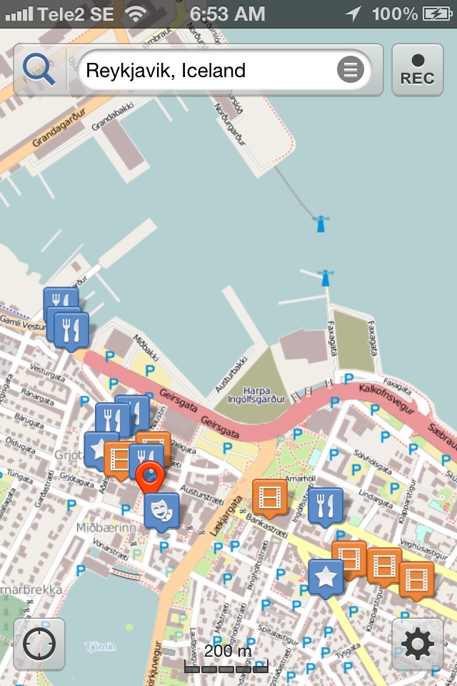 |
| Reykjavik, Iceland |
I wanted that application to support unlimited custom bookmarks, so I could annotate my maps. That way I don’t need to look anything up twice. Again, I didn’t want to assume I’d have internet access while on the move. And I didn’t want to stop at an internet cafe (or any other stop) every time I needed to consult a map.
I also hoped to find something where I could share and export maps, during and after the trip, for my own records, to share with friends, etc.

I found, downloaded, and used Galileo, and absolutely loved it. Two thumbs up for this app. It’s not perfect, nothing is, but it met my requirements well. Here are some screenshots of annotated cities, after I’d done my research and marked some spots. The caching and zooming and navigation worked well, even without internet access of any kind.
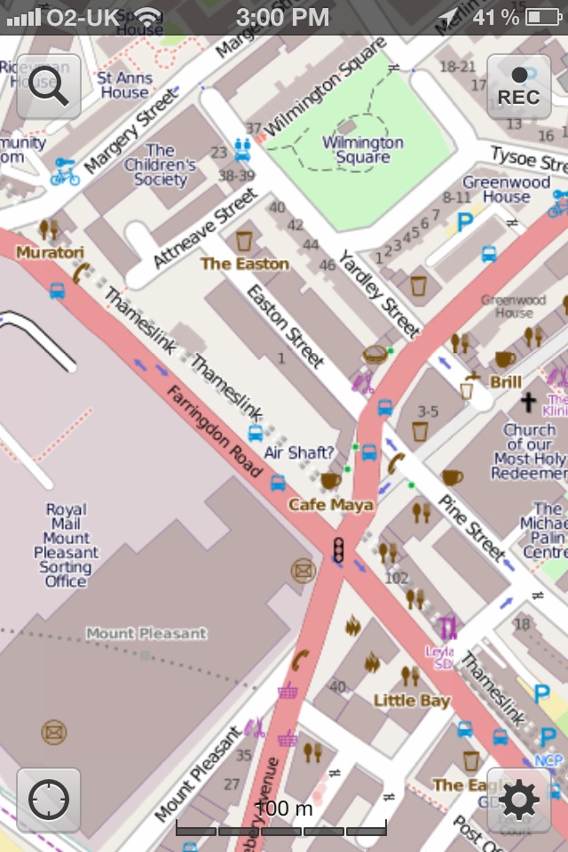 |
| Air Shaft? Don’t know. But nice place coverage. |
The data coverage in major areas (middle of Moscow, London, etc.) was good, as was the data coverage in rural Iceland and other areas. I wish they had more categories with visually-distinct icons, but you can use custom icons after all, and I never bothered.
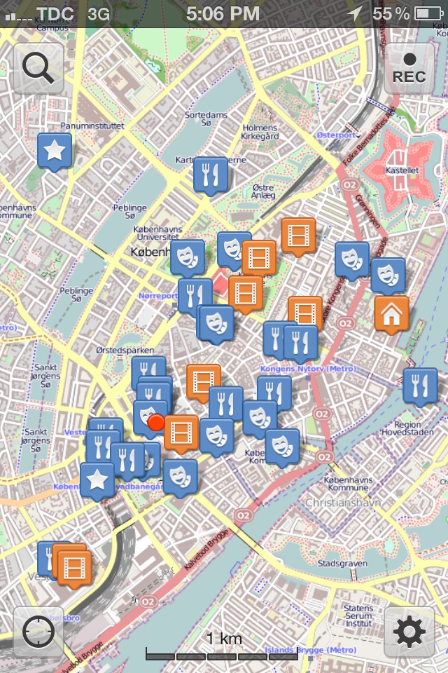 |
| Copenhagen research… |
My one major complaint about Galileo is the address search. It seemed like it always returned results at the city level only, making the search nearly useless. That is, any street address you put in, it just recognized the city and took you there. Very strange.
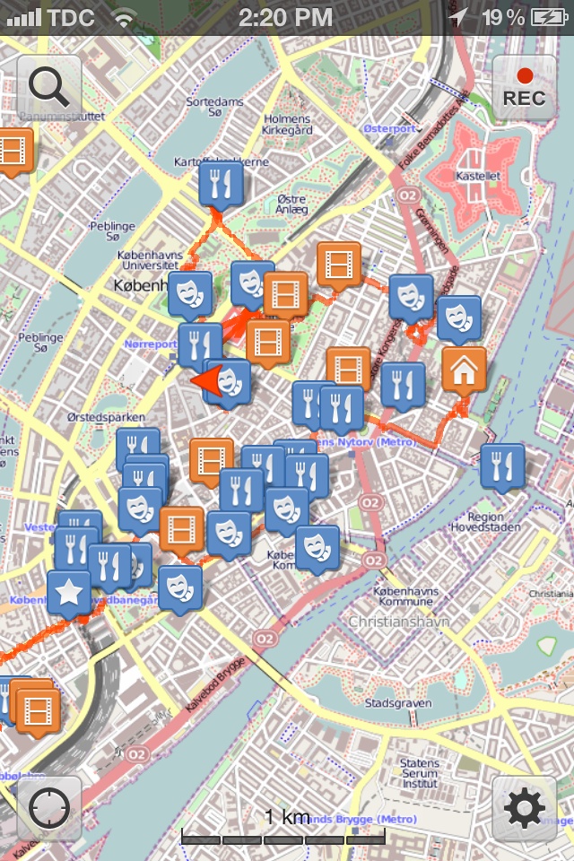 |
| Same Copenhagen map, but with today’s walking route (red line) marked. |
Some readers probably know I also used Foursquare a lot during my trip. I did, but that was to serve a different need. There’s a whole separate post on Foursquare coming up tomorrow.
When relying on digital technology, you always risk it breaking, not working, running out of battery power, and similar concerns. Because I was in big cities, the risk was somewhat mitigated. When I go hiking in remote outdoor destinations, I still get printed maps (ideally recent high-detail topos, etc.)
But for this trip, the above setup worked really really well. I’m very happy with it. I didn’t find myself needing a printed map often, if ever. I might have consulted big printed maps on the streets a handful of times, at most, just out of laziness or curiosity.
I also am lucky to have a fairly good sense of direction, so I can navigate fairly easily, and I’m handy with a compass (digital or old school), so I’m relatively confident. This helps, but the technology advances of maps on recent mobile devices help even more.
