This blog post is a detailed accounting of a hike Alissa and I did this past Saturday, January 12th 2013.
 |
| Up Valley Way near the Madison Hut. |
We did the Presidential Traverse, a fairly well-known hike that encompasses climbing up and down all the mountains named after US presidents in New Hampshire’s White Mountains. You should read the brief Wikipedia background if you haven’t.
For some background, here’s a good Backpacker Magazine article (“A winter traverse of the Presidential Range is the most coveted–and riskiest–mountaineering feat in the Northeast.”) and another good one from the AMC Outdoors magazine (“Attempting a Presidential traverse in winter is like playing Russian roulette with the weather.”)
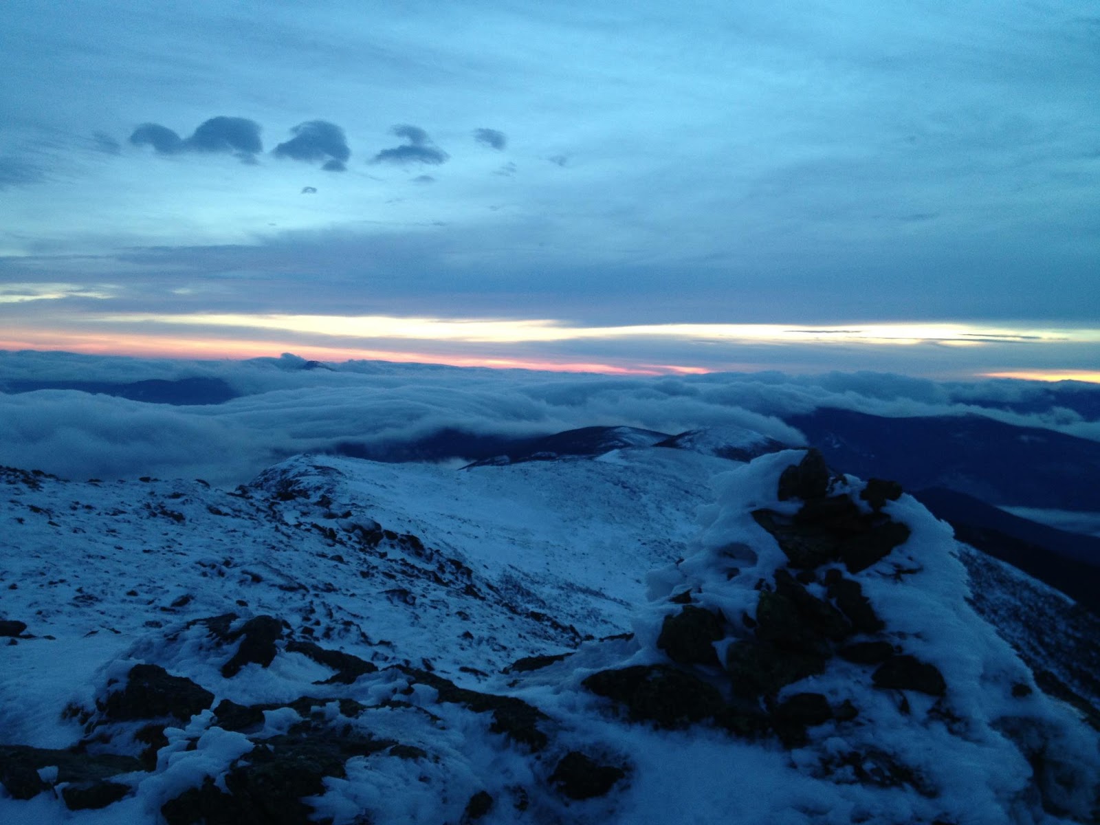
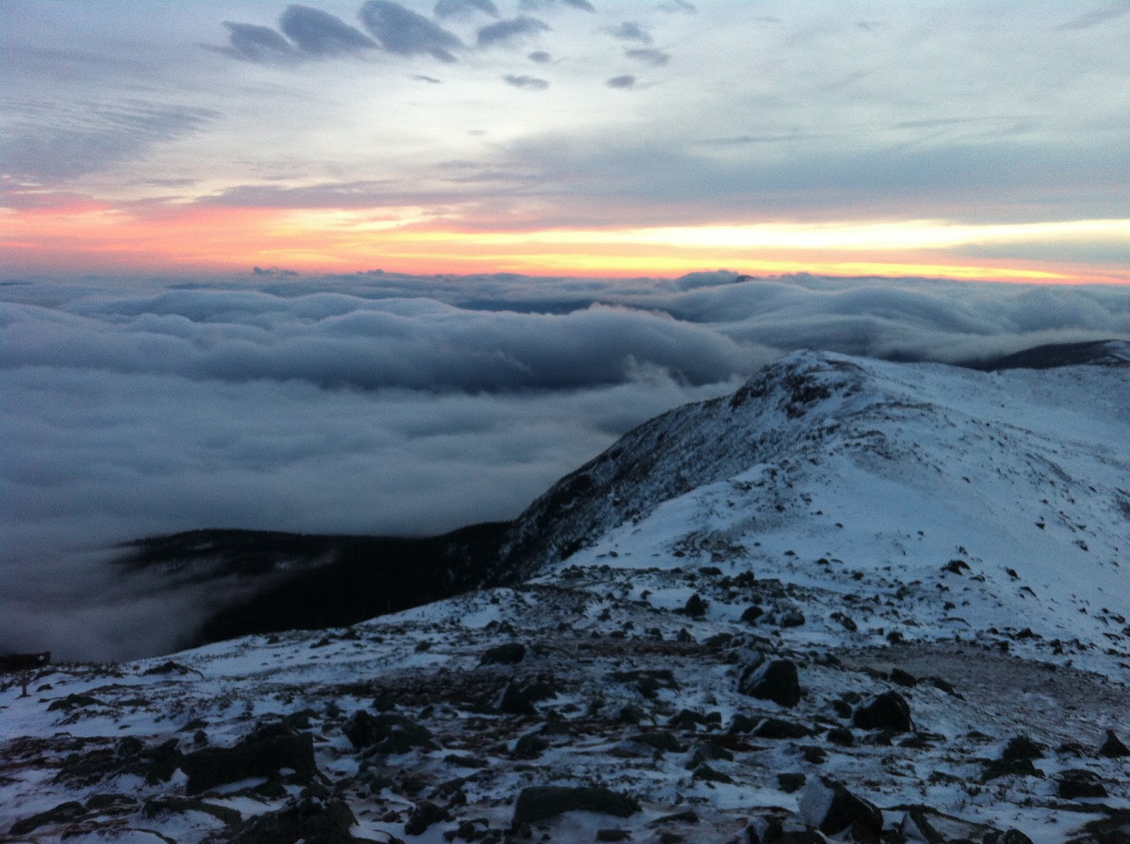 |
| Sunset near Mount Eisenhower. |
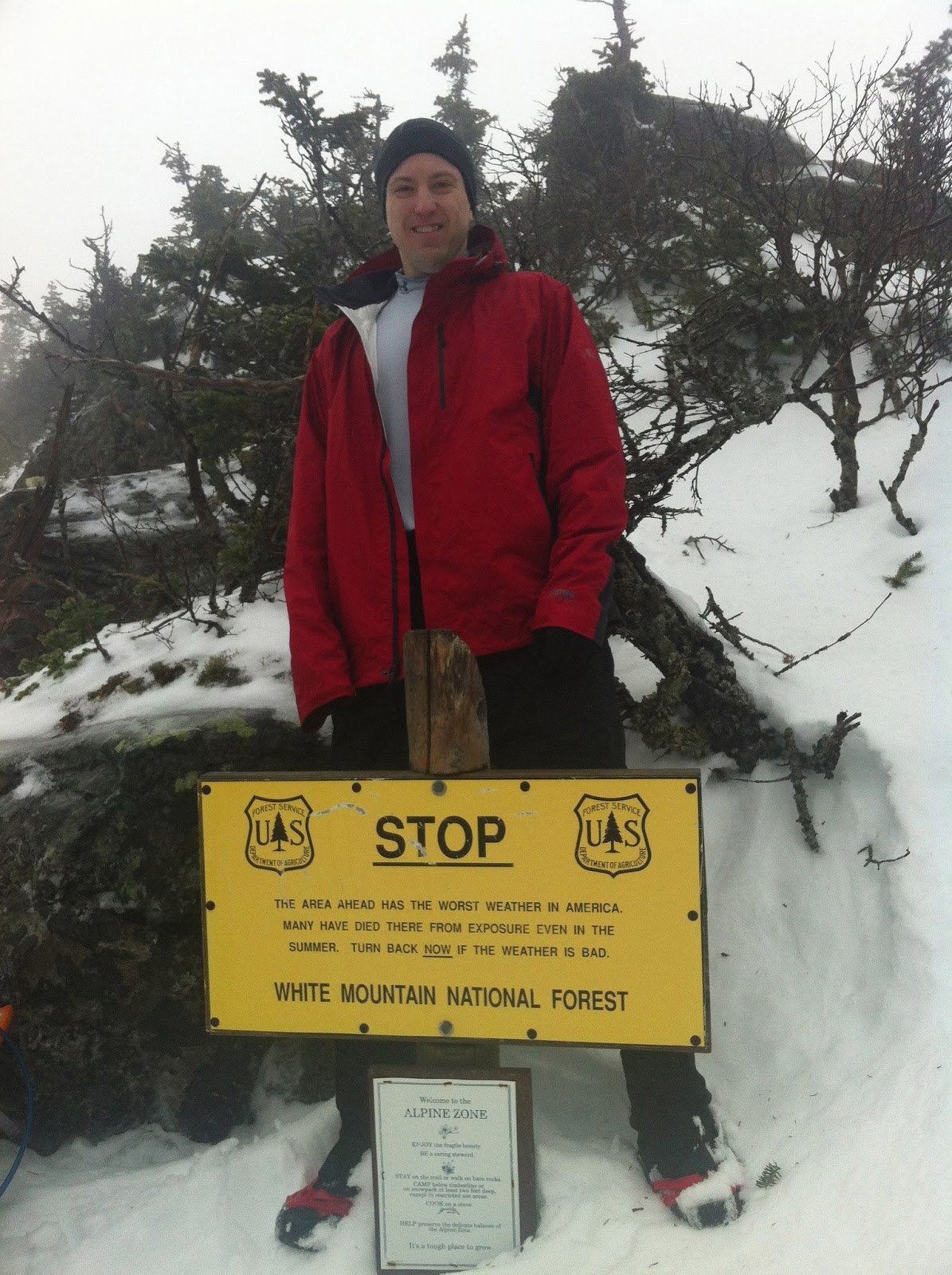
You might have noticed those two articles are from 2008 and 2006, respectively. That’s kind of old in our internet age. This is because very few people attempt a winter Presi. The rest of this article contains more details, but this is a dangerous hike. It’s long, strenuous, subject to intense weather, and thus requiring serious gear, real outdoor orientation / route-finding / navigation skills, and a high level of fitness. Please don’t read this and try it unless you’re very sure of what you’re doing.
Unless you’re a hiker, you might find this overly verbose and/or boring. I am writing it because when we did our research, we found very few (less than a handful) trip reports for doing this hike in the winter, and especially in one day. The (very) few folks who do this hike at all seem to do it in a couple of nights, sometimes one night, but hardly ever in a day. Hopefully this will be useful to similarly-aggressive hikers 😉
If you’re a reader of this blog, this blog post might seem familiar. Alissa and I did the same traverse, also in one day, but in the late summer / early fall, and I wrote a trip report for that. It’s obviously much safer and easier (in some ways, not all…) during a warm summer day, with many other hikers around.
Alissa has her own great blog, and she’s written up her own account of our hike, with considerably more humor than mine 🙂
 |
| Alissa tagging another summit. Hat off, no weather concerns, ice tools fastened. (That’s my ice axe in the snow.) |
As Wikipedia notes: “Consequently, those wishing to tackle a Presidential Traverse in winter must be exceptionally fit, experienced in winter mountaineering and compass orientation techniques, very familiar with the terrain, and have high quality winter gear. Lacking any one of these puts one in serious peril of requiring expensive and hazardous rescue, even death.”
That said, if you can do it, the rewards are awesome. The views are spectacular, assuming you get any clear windows. We had a total whiteout on the initial couple of ascents, and then a nice clear afternoon before the early sunset. There may well be no one else on the trails, at all, much less the summits, so you get all the quiet and solitude you want. The surface mixtures presents really fun crampon / microspike / snowshoe / boot challenges. And the overall feeling is great, but you already know that if you’re even contemplating this hike,
OK, on to some details.
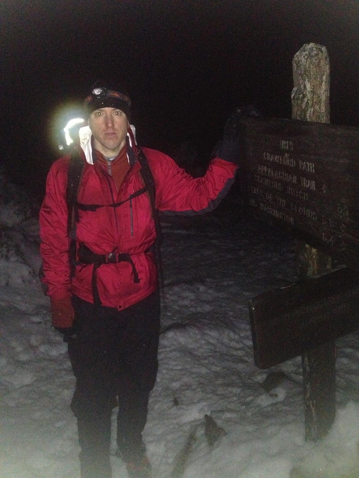
We did the “classic” traverse route, going north to south, starting at the Appalachia trailhead and ending at the AMC Highland Center in Crawford Notch. Not many people do this traverse in any season, but when they do, this is the common route. Most do this in 2-4 nights, depending on their level of fitness. We wanted to do it “Alpine-style,” meaning we had to go fast and light. As people say, “in the mountains, speed IS safety.” This can be very counter-intuitive, until you grok the meaning of “objective risks.”
We got started later than our summer Presi, both because we wanted to get an extra hour of sleep (we only had about 4 hours anyways, due to late arrival and Boston-area road traffic on a Friday evening…), because we knew we’d be doing bunch of hiking by headlamp anyhow, and because we knew the weather would be warming up a bit as the day went on. Our official start time was 5:42am.
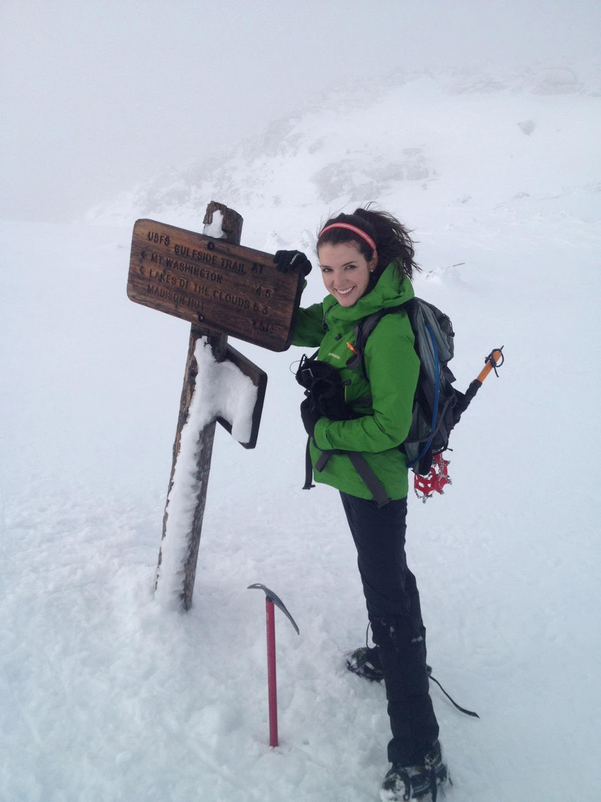
 |
| Near Edmands col. |
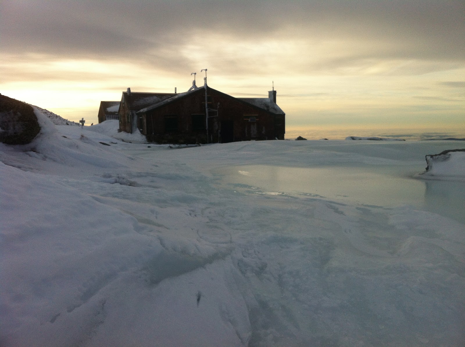
We took the Valley Way trail from Appalachia to the Madison Hut, a gain of more than 3,000 vertical feet over a little more than 3 miles. The route was nicely snow-packed, and we made it to the hut a little before 8am, a good pace. Sunrise was not much of a sight, because a dense wet fog was covering everything, so we couldn’t see much. We actually didn’t see the big hut building until we were about 30 yards from it 🙂
We tagged Mount Madison’s summit about 20 minutes later, in a quick scramble up from the hut. The winds were gusting to about 50mph, well higher than forecast, and continuing the wet whiteout conditions. Nonetheless, we’re both used to strong winds in the Whites, and this was a fairly easy ascent.
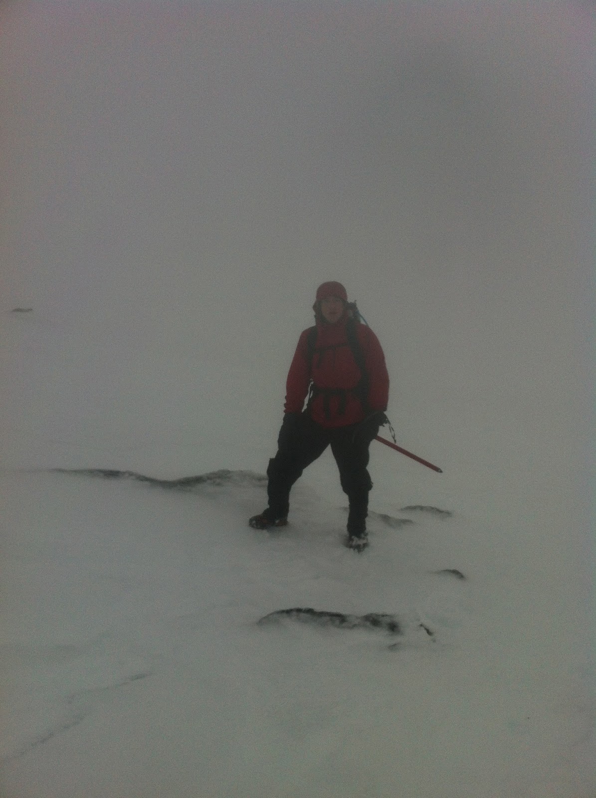 |
| Yours truly ascending up Mount Madison in a whiteout. |
We did drop our packs at the Hut (outside obviously, since like all huts, this was is closed and locked down), but just for speed. This way we could practically almost jog up and down Madison’s summit cone.
By the way, for the curious: neither Alissa nor I use hiking poles, since we have decent balance and go faster without them, but YMMV. Some people really like them, but I’ve found my balance and speed improved once I stopped using them.
We cam down from the summit, had a snack, put on the packs, and set out towards Mount Adams. We both prefer the Star Lake trail to the Gulfside trail at this point, even though (or maybe because…) Star Lake is more exposed and challenging. In the summer, this trail yields amazing views, but in the winter whiteout conditions, the views were about the same everywhere.
 |
| A summer view of the top of the Star Lake “trail,” whose scrambles we love but others don’t, by Pixel. |
Mount Adams had chest-deep snow everywhere, and while Alissa scampered gracefully, for me this was the hardest ascent of the day. We made it up at 9:20am, about an hour after Madison, which is about the same pace as our summer Presi, i.e. reasonably fast.
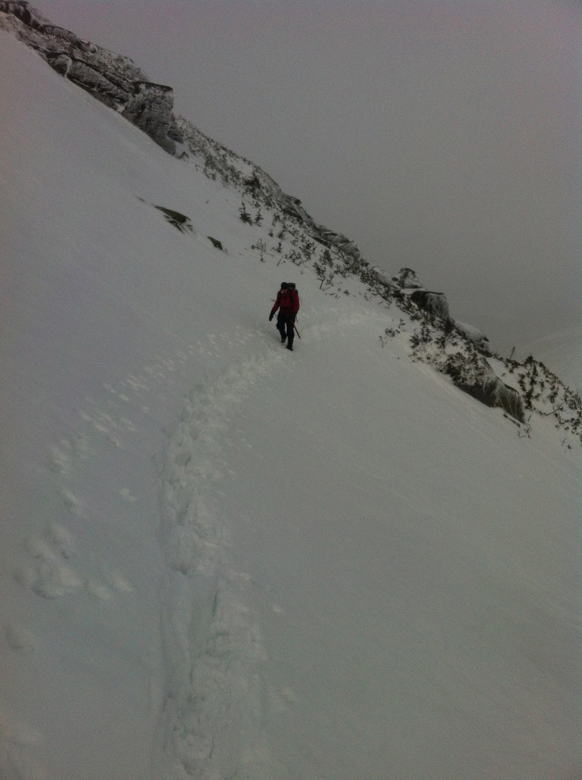
We continued down the Gulfside trail, i.e. traversing Mount Adams, to Thunderpoint Junction. We made it to the junction side quickly, in less than 30 minutes, despite the continuing whiteout. Here, however, was the one place where we got a little lost.
Cairns were hard to find in the snow and fog, but we saw snowshoe tracks, so we followed them a bit. Within 0.1-0.2 miles, we both realized we were off trail. This is where it pays to know the surrounding environment well, and to have some route-finding skills.
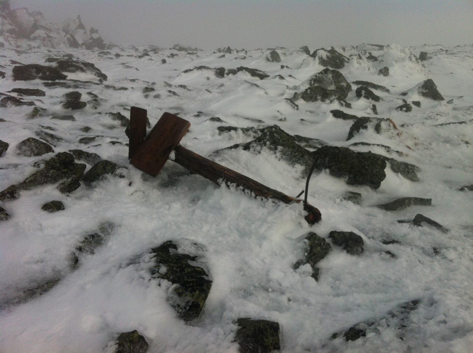 |
| A fallen USFS trail sign near Edmands Col. What kind of wind would it take to rip this out (16″ iron base supports??) |
After a quick discussion and map + compass consultation, we decided to follow the ravine line towards Mount Jefferson, our next summit, knowing we’d find Edmands Col that way and get back on the Gulfside trail, just because of the geography of the immediate area. Sure enough, after another ~0.2 miles hiking southwest along the ravine line, we picked up a cairn and the trail, always a re-assuring thing.
We passed Edmands Col and ascended Mount Jefferson, one of my favorite summits. Even in the summer, you often have this summit to yourself, with its gorgeous views. I don’t know why it’s overlooked. Needless to say, on this winter day, we didn’t see anyone even remotely around, but that was pretty much true for the whole hike.
We tagged Mount Jefferson at 11:45am, a bit more than two hours after Adams, partially due to losing our way a bit, and partially because it’s a long slog. In the summer we were able to jog much of this part, but not this time.
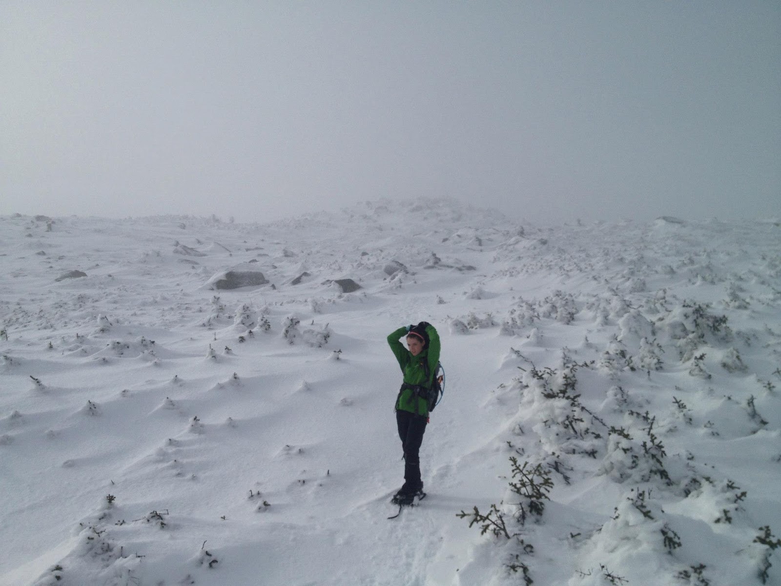
|
| On our way to Jefferson. Those are trees buried in snow, and Alissa is warm enough to take off her hat… |
Fun fact: In doing Mount Adams, Mount Jefferson, and Mount Washington in sequence, you climb the three highest mountains in the northeast US, right after each other.
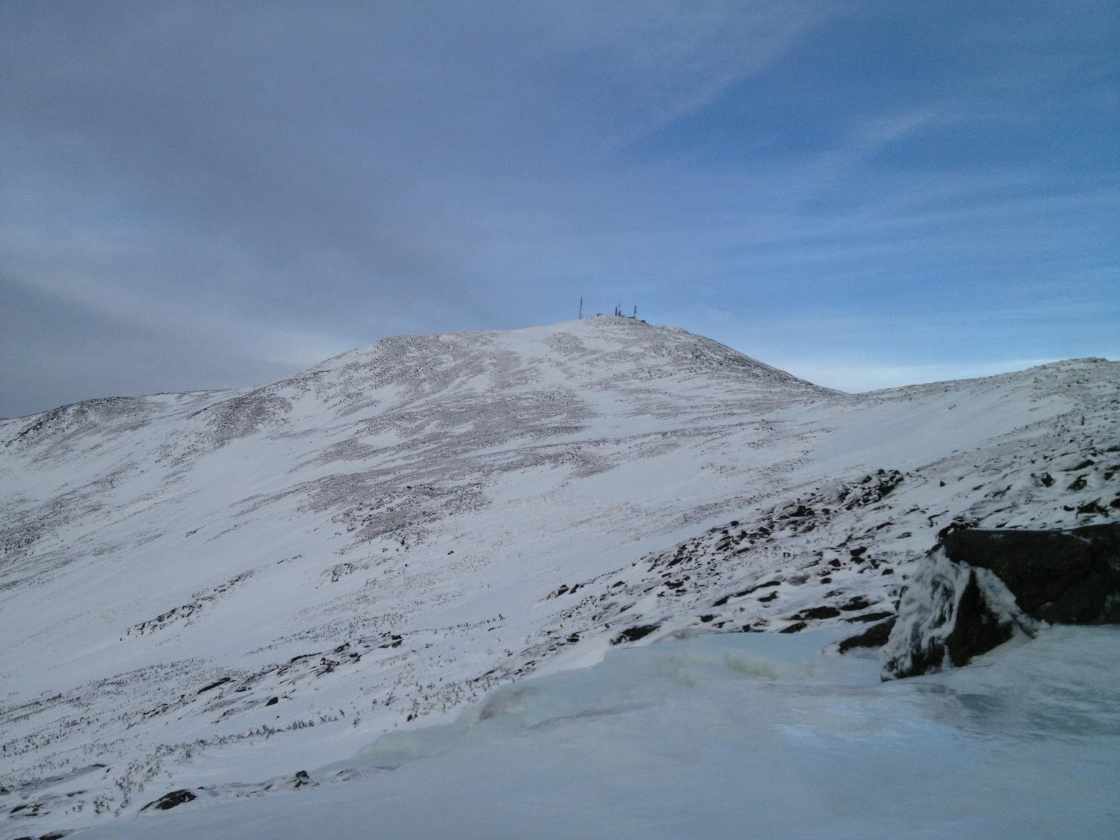
From Jefferson we continued towards Mount Washington on the Gulfside trail. You pass Mount Clay, a relatively minor peak but still part of the range. This was a good mental checkpoint for me, because you know the biggest climb is ahead (Mount Washington), but you have a good gauge on your physical fitness, having done three serious summits and several thousand feet up and down already.
 |
| Me ascending past Mount Washington’s Cog Railway. |
The good news is that I was feeling strong, and getting stronger, at this point. Alissa is pretty much always strong, though we kept checking in with each other at regular intervals, making sure we agreed on the current bailout route if that was needed.
Near Mount Washington is where we saw the only other group of hikers that day. There were six of them, all in snowshoes. Apparently they were trying for a traverse, too, but we were passing them quickly even though they started more than two hours ahead of us. They had already decided to bail out after Mount Washington when we got to them.
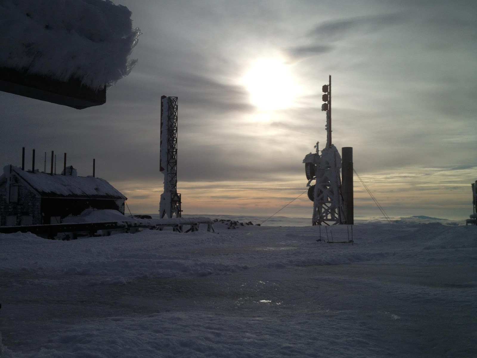 |
| Mount Washington summit in the early afternoon. |
I’m pretty sure our relative ascent speed in our crampons and no poles, compared to their snowshoes and poles, did not help motivate them to go on. I think they made the right decision to bail out, though, and applaud them for not having summit fever.
Our ascent of Washington was quick and uneventful. By this time the weather had cleared up somewhat. I was on the summit the previous weekend in much tougher conditions, with a bigger group, so this part felt easy. And to my surprise, I found that the more I climbed, the stronger I felt.
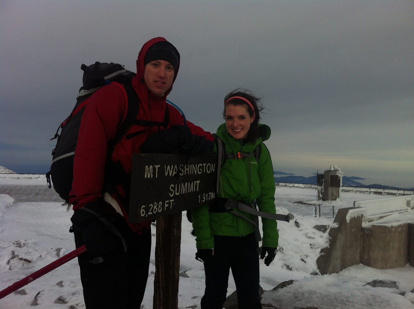 |
| One of the snowshoers took the only picture of us together during the hike. |
We tagged Washington’s summit just after 2pm, a little after the time I’d gotten there the previous weekend just doing Lion’s Head up from Pinkham Notch, and about 2 hours and 20 minutes after Mount Jefferson.
 |
| Another Mount Washington Summit view. |
After a quick obligatory picture break at the summit, we kept moving, not even stopping to eat. I knew I wanted to check out the emergency refuge in the Lakes of the Clouds hut, so we’d get a snack there, and change socks.
We were able to hustle down the ~1-mile distance to the hut, and find the refuge. We got to the hut at 3pm, about 45 minutes after leaving Mount Washington.
 |
| Never been alone at the Lakes of the Clouds hut. Gorgeous afternoon views. |
My socks were wet, a bad thing, although my feet were feeling fine. Nonetheless, I changed into my spare liner socks, spare outer socks, and put on new toe warmers, just to be safe. This worked, and I’m glad I carried these extras, as I always do in the winter. We took about 20-30 minutes here to do the above, plus eat, drink, re-hydrate, assess how we were feeling, etc. We both agreed, easily, that we can finish out the traverse, so we set out.
 |
| Looking back north towards Mount Washington from the Lakes of the Clouds hut. |
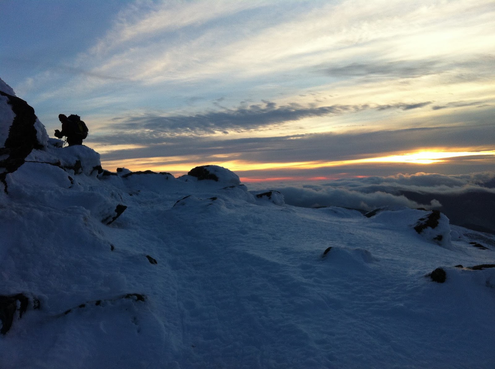
Mount Monroe, the next peak, is one of my favorites. It’s a relatively easy and short ascent, at least if you’re in decent shape, and the views are stunning. You often get great views looking back north towards Washington. We also had the sunset and its highlights on the southern Presidentials which were still ahead of us. We reached Mount Monroe at 4:15pm, with the sun close to setting.
 |
| Moving south towards Franklin. |
From there we continued to Mount Franklin, not technically required for the Presi, but an extra peak we bagged in the summer, and so we tagged it this time as well. The views were still stunning, with the sun right behind the enormous cairn at the top of Mount Eisenhower, the next Presi-required peak. We tagged Mount Franklin at 5pm, around the time we turned on our headlamps.
From the summer, I remember the slog between Franklin and Eisenhower being long and annoying, but maybe it’s because I stopped a couple of times to help other hikers, including splinting someone’s ankle. Yay Wilderness First Responder training!
This time, however, hiking at night by headlamp, all by ourselves with no one for miles around, it was a great time. We made it to the summit of Franklin by 5:45pm, so we were moving really fast, especially considering the length of the hike to this point. We both enjoyed looking at the stars come out, and we could see the lights from the Bretton Woods ski resort nearby, a gorgeous clear night.
 |
| This passage near Mount Jefferson reminded me of the Hinterstoisser Traverse. Thank god it’s not. |
The hike from Eisenhower to Pierce is pretty easy, and much of it is at the very top of the tree line. We reached Mount Pierce around 6:30pm, and stopped for a while, turned off our headlamps to look at the stars. It was perfectly quiet and still, no one else around, and plenty of shooting stars. A moment like that is pretty hard to find.
From Mount Pierce we chose not to do the detour to Webster, which is not named after a president and adds a very boring couple of miles to the trip. I personally felt like Mother Nature had graced us with amazing weather for ~6 hours, after the morning whiteout, and I didn’t feel like pushing our luck more than needed.
Instead, we booked it down Crawford Path to the AMC Highland Center. That’s still a non-trivial hike, more than 3 miles and 2,000 feet of elevation drop, but we booked it, feeling strong, and ready to jog out the rest of the way. We reached the AMC Highland Center in the dark, roughly 14 hours after we started the hike, 2 hours slower than our summier Presi pace.
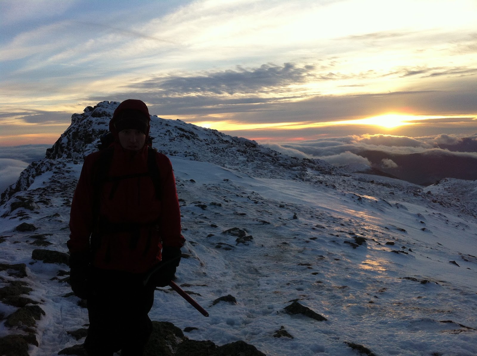
 |
| Unparalleled views in the afternoon, just before sunset, near Mount Eisenhower. |
All in all., this was one of the best hikes I’ve ever done, maybe the best (up with the Inca Trail to Macchu Picchu.) The physical and mental challenges are equal, and both are immense. You should definitely do a summer Presi, and feel like you’ve got that covered reasonably easily, before even thinking about a winter attempt.
In terms of gear, it’s the same principle as always: layers, insulation, no cotton (all moisture-wicking synthetics or SmartWool), have spares you can change into, and adjust by listening to your body. Don’t get wet, because whatever’s wet will freeze, and then you’re in trouble. You should be warm while moving, and then put on an extra layer while resting.
 |
| Near Mount Monroe. |
We didn’t rest often, drinking water on the go from our CamelPaks, and eating small bars and snacks pretty much every hour or so. I had a number of Clif’s Shot Bloks bars, a couple of Kit Kat bars, a couple of Red Bull energy drinks, some salami and cheese, and some of Alissa’s Chex Mix. It’s actually not a lot of food, given that we spent several thousand calories each on the hike, easily.
I did drink all 5 liters of water I brought with me. This is bad, and it means I should have brought more water. Alissa had plenty of spare water, since she apparently never drinks 🙂 So I drank most of hers as well, and ended up hydrating just fine.
I had my big bomber Mountain Hardwear parka in my pack, but never used it. Alyssa used hers briefly on Mount Madison, but then didn’t use it again the rest of the way. That’s partially because we both kept moving all the time, and also because we’re used to the weather, and because the afternoon was relatively calm in terms of winds.
 |
| Tagging Mount Pierce, our last summit of the day. |
I wore an expedition-weight base layer, insulating shell pants, a winter running zipup, and my light rain shell all day, along with a thermal beanie, liner socks, and thick mountaineering socks, liner gloves, and mitts. That’s it. I had a balaclava but never used it. Same with my extra top layer, my parka, and my goggles.
I had the ice axe in my hands pretty much the whole time, but more out of habit than need. I only used it a couple of times in icy spots.
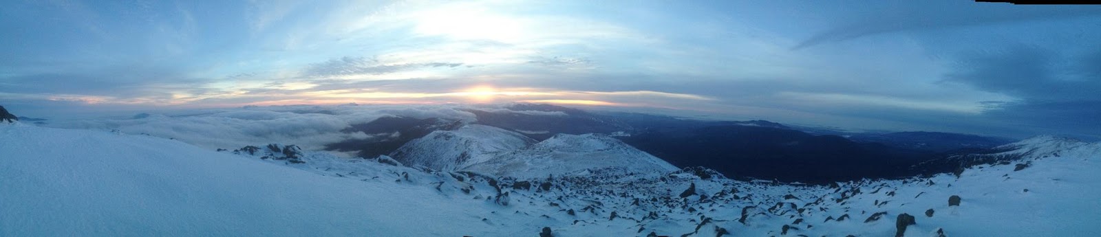 |
| Panorama shot near sunset. Love this one. |
I’m happy to add more material to this post if readers have questions. Just post them in the comments below.
Finally, but most importantly, some thanks: to Alissa, the best hiking partner one could hope for, always strong, fast, encouraging, and happy. To Ron, who offered to pick us up from any trail head we wanted in the White Mountains and be our bailout. To Hua (my friend) and Hugh (Alissa’s dad), our safety watchers from home.
Climb on 😉
